Easter in Motion: The Kwahu Experience
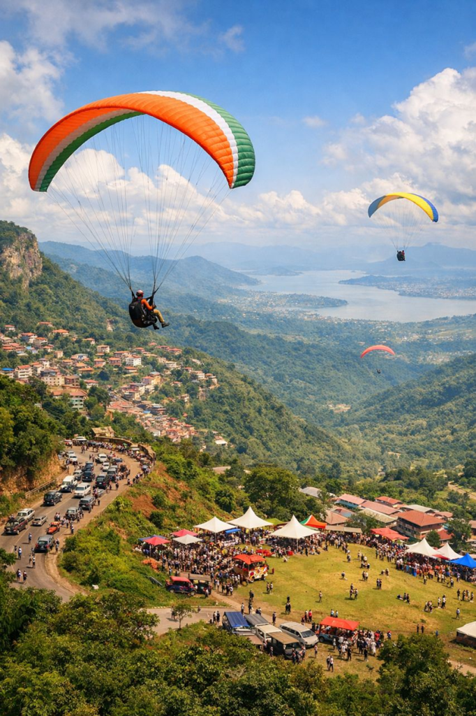
Each Easter, the roads leading out of Accra transform from simple exits into waiting rooms, as thousands of travellers’ head to the Kwahu Ridge. Over the years, Kwahu has become the assigned haven for Easter festivities, where people escape the city’s heat and immerse themselves in paragliding thrills and vibrant street celebrations.
Journeys begin as early as the Wednesday before the Easter weekend, with major corridors carrying steady streams of vehicles. The N1 corridor dominates, funnelling traffic from Achimota through Amasaman to Nsawam before feeding into the N6, the principal spine toward Kwahu. Another stream departs through Adenta, climbing the Aburi Hills along the N4. Beyond Aburi, traffic splits: one branch continues through Mampong toward Koforidua to re-join the N6 at Bunso, while another descends through Amanfrom to meet the Nsawam–Suhum stretch.
A quieter, strategic movement emerges through Dodowa, which doesn’t offer a complete bypass. Vehicles redirect via Larteh to meet the Aburi route at Mamfe, or via Adukrom to connect with the Koforidua–Nsutam road, eventually feeding back into the N6 at Bunso. From the Tema side, a longer arc moves through Ashaiman along the Tema–Afienya–Somanya corridor. One branch reconnects via Asutsuare and Adukrom to the N4 toward Bunso, while another turns at Adawso, climbing directly to Kwahu Tafo and bypassing Nkawkaw altogether.
Despite these multiple options, convergence is inevitable. All streams ultimately funnel into critical junctions at Nsawam and Bunso, creating sharp peaks in traffic and a gradual build-up of delays. Nkawkaw then becomes both gateway and bottleneck, where the broad highways meet the narrow, winding mountain roads. Beyond this point, steep gradients and tight curves restrict speed and overtaking, making even minor interruptions escalate into long delays.
What unfolds on the ridge is not just congestion, but a system operating beyond its capacity. This pattern is not new and it is consistent. It is at this point that the question shifts from how people move, to how movement is managed. Because what the Easter journey to Kwahu reveals each year is not merely a surge in travel, but the limits of a network asked to carry more than it was ever designed for. The instinct, often, is to search for alternative routes, as though the problem can be solved by finding a quieter road. But as these patterns reveal, alternatives rarely remain independent for long; they are gradually drawn back into the same constrained corridors. The challenge, then, is not simply about where vehicles go, but when and how they move through the system.
One way to address this is through guided movement: actively directing traffic along existing corridors, rather than leaving it to self-distribution. The routes through Aburi, Dodowa, Somanya, and the Tema-Akosombo side already exist as functional alternatives, but without coordination they operate less as relief channels and more as parallel streams that eventually converge. With timely traffic advisories, temporary diversions, and visible route management at key decision points, demand can be distributed more evenly, preventing the sharp peaks that overwhelm the system.
At the threshold of the ridge, however, a different strategy becomes necessary. Nkawkaw already functions as the primary gateway into Kwahu, sitting at the base of the escarpment and funnelling movement upward toward Mpraeso, Atibie, and Obomeng. Informally, this has produced a kind of “park-and-move” behaviour, where travellers leave vehicles and rely on taxis and minibuses to navigate the ridge. Formalizing this into a structured park-and-ride system presents a practical opportunity. Designated holding and parking areas on the outskirts of Nkawkaw could absorb incoming vehicles, while coordinated shuttle services move people upward in controlled volumes. In doing so, the number of private vehicles attempting the climb is reduced, easing pressure on the most fragile segment of the network.
Beyond this point, the ridge roads themselves demand a more deliberate form of control. Their narrow widths, steep gradients, and sharp curves, naturally limits capacity and resists the kind of bidirectional flow currently imposed on them. Introducing temporary one-way traffic loops, alongside clearly defined entry and exit routes, could significantly improve conditions. By separating opposing streams and regulating access onto the ridge, conflict is reduced and movement becomes more continuous. The journey may remain slow, but it becomes predictable, replacing long, irregular standstills with a steadier progression.
Taken together, these measures point toward a broader shift in approach. Managing how vehicles are distributed, how they transition between systems, and how they move within constrained environments offers a more immediate and realistic path to improvement.
In the longer term, however, there is space to think beyond the road network altogether. The scale and consistency of the Easter migration suggest the viability of alternative transport modes, particularly coordinated mass transit systems. Whether through high-capacity buses or even limited shuttle air services linked to nearby hubs, diversifying how people access the ridge could gradually reduce dependence on private vehicles. Such options may not replace road travel, but they could begin to complement it, easing pressure on a system that, for now, carries the full weight of the journey.
None of these interventions require a complete redesign of the network. They demand coordination, anticipation, and a willingness to treat movement not as an individual choice, but as a system to be actively managed.